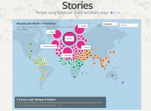
The link below connects to an interactive map that allows the user to visualize which countries are most socially connected to other countries through Facebook friends. Try to predict which countries are most socially connected and then click on a country and find out if you are right. The importance of language, historical connections, migration patterns, population size, and distance are all on display. Mexico is the largest source of friends for U.S. facebook users followed by Canada and the Dominican Republic. By contrast, for Canada, Australia is the largest home of its international friends, followed by the U.K., U.S., Philippines, and Hong Kong. Haitians are most connected to the Dominican Republic, Canada, U.S., and France, in that order.
http://www.facebookstories.com/stories/1574/#color=continent&story=1&country=HT

Some very cool work by Stamen. The people at Stamen are really shaking up the cartography and data viz spaces. You can see more of their work here: http://stamen.com/
One product that I really like is their watercolor tile set that is built via an algorithm applied to OpenStreetMap data. http://maps.stamen.com/watercolor/#13/44.3335/-93.9600
They will likely be here in Minnesota for the FOSS4G North America Conference. http://foss4g-na.org/