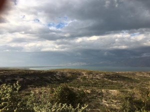
Clouds roll in over Lake Enriquillo, Dominican Republic, last month. The lake is both the largest lake in the Caribbean and the lowest elevation in the Caribbean. Over the past decade, the lake has greatly expanded, flooding a village and acres of farmland. (Photo by Anna Versluis)
Here’s some interesting geography news from my part of the world: National Geographic: The Relentless Rise of Two Caribbean Lakes Baffles Scientists. We drove past both Étang Saumâtre and Lake Enriquillo recently and wondered why they were rising. We saw houses under water and noticed that the Dominican immigration and customs houses seemed new and yet temporary. This article provides an abundance of theories to explain the lakes’ rise: climate change causing greater rainfall, Dominican irrigation canals diverting river water into the lake basin, the 2010 earthquake disrupting groundwater flow, erosion leading to lake sedimentation and thus higher water levels, and more. What do you think?
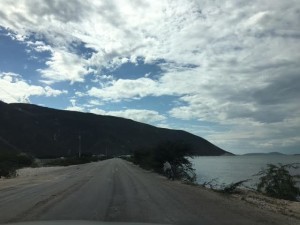
A view of the Haiti-Dominican Republic border at the Malpasse/Jimaní crossing. Étang Saumâtre, the lake on the Haitian side, continues to rise as well. The road to cross the border here has been raised to the point it is a causeway. (Photo by Anna Versluis.)