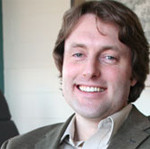
In celebration of the new GIS minor at Gustavus, the Department of Geography is excited to announce an upcoming talk by Dr. Steve Manson, Associate Professor of Geography at the University of Minnesota:
“Geographic Information Science: Maps, Society, and Technology.”
Friday, March 7, at 3:30pm in Olin Hall 103, Gustavus Adolphus College
Steven Manson is an associate professor in the Department of Geography, Environment and Society at the University of Minnesota in the Twin Cities and Director of the Human-Environment Geographic Information Science lab. Dr. Manson combines environmental research, social science, and geographic information science to understand complex human-environment systems. He is a Resident Fellow at the U of Minnesota’s Institute on the Environment and is a past NASA New Investigator in Earth-Sun System Science and NASA Earth System Science Fellow. He received the Young Scholar Award from the University Consortium for Geographic Information Science, the Sustainability Science Award from the Ecological Society of America, and a University of Minnesota McKnight Land Grant Professorship. Dr. Manson teaches in the areas of geographic information science and spatial analysis of human-environment systems.
Geographic Information Science (GIS) is a fast-growing field that studies the spatial and temporal aspects of people, places, and processes using information technologies. It encompasses technologies ranging from satellite imaging and geographic information systems to mobile phones and internet social networks. The White House identifies spatial technology alongside nanotechnology and biotechnology as one of the three most important industries in the 21st century, and one that accounts for a trillion dollars of economic activity annually. Geographic Information Science also reflects the interplay of society and technology as mapping technologies spring from and play out in a social context. There are many helpful spatial technologies, such as computer programs that route ambulances or track packages, but they are joined by more questionable ones, such as systems of surveillance of consumers and citizens used by a wide array of organizations.
The talk is free and open to the public. It is sponsored by the Department of Geography, Environmental Studies Program, and the Lyceum Lecture Series.
